


Gilpin 4, Gilpin County, Colorado
About
Outline

Summary
| Unique Area Identifier | 548233 |
| Name | Gilpin 4 |
| County | Gilpin County |
| State | Colorado |
| Area (square miles) | 8.56 |
| Land Area (square miles) | 8.56 |
| Water Area (square miles) | 0.00 |
| % of Land Area | 99.98 |
| % of Water Area | 0.02 |
| Latitude of the Internal Point | 39.86655290 |
| Longtitude of the Internal Point | -105.49993850 |
Maps


Graphs
Select a template below for downloading or customizing gragh for Gilpin 4, Gilpin County, Colorado


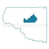
Neighbors
Neighoring Voting District (by Name) Neighboring Voting District on the Map
- Gilpin 2, Gilpin County, CO
- Gilpin 3, Gilpin County, CO
- Gilpin 5, Gilpin County, CO
- Gilpin 6, Gilpin County, CO